

Save Time and Money Flying LiDAR to Collect your Data
SkyVue, is an aerial mapping and LiDAR service provider. Our objective is to use our advanced LiDAR technology to provide accurate, reliable, and cost-effective solutions for maintaining the safety and efficiency of your companies, operations and projects.
One of the key benefits of using SkyVue as a drone service department is that it would allow companies to focus on their core business activities while leaving the drone-related tasks to the experts. SkyVue has a team of highly skilled and experienced drone operators who are well-versed in all aspects of drone technology. This means that companies can be assured of receiving top-quality services that meet their specific requirements.
Additionally, by outsourcing drone-related tasks to SkyVue, companies can save time and money, as they would not need to invest in expensive drone equipment, training, or maintenance. SkyVue's goal is to help businesses operate more efficiently and effectively by providing reliable, cost-effective drone services that meet their needs.
Services
-
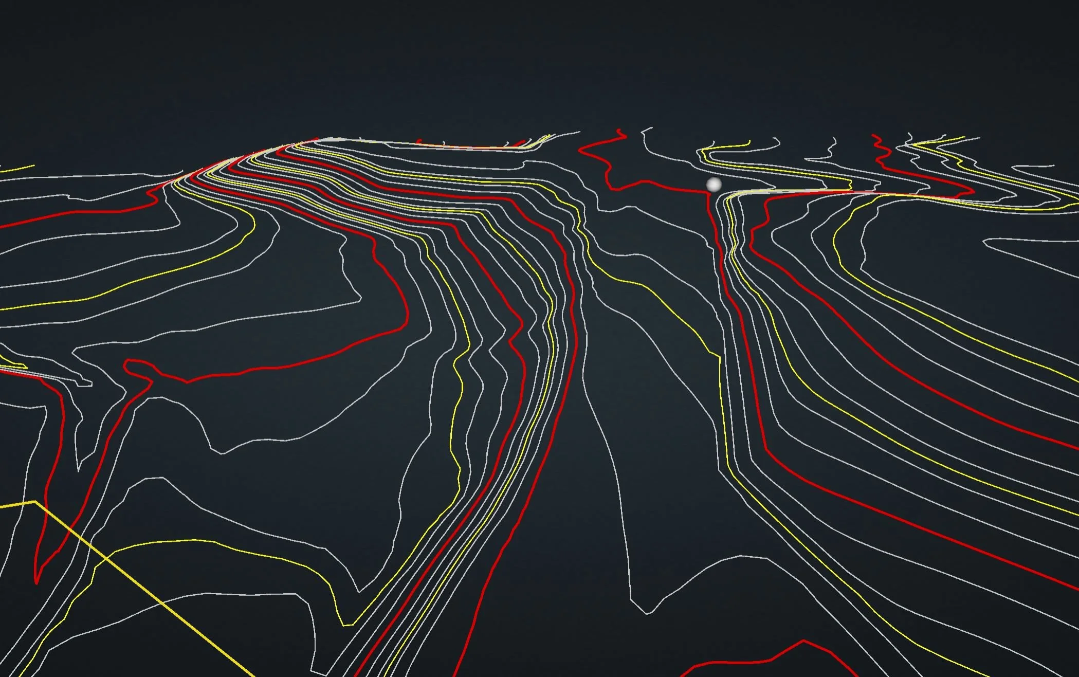
Topography Surveys
Lidar data can be used to create accurate topographic maps that show the elevation and shape of the land, as well as the location of features such as buildings, trees, and bodies of Architecture and engineering water. Overall, lidar has revolutionized the field of topographic mapping even through thick vegetation
-
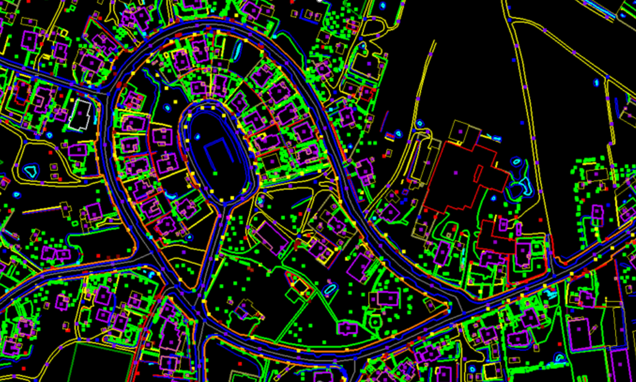
Planimetric As Built
Ground Features can be extracted from LiDAR data by using specialized software to analyze the data and identify patterns that correspond to different types of planimetric features. The software can then create a map or a 3D model that shows the location and shape of these features
-
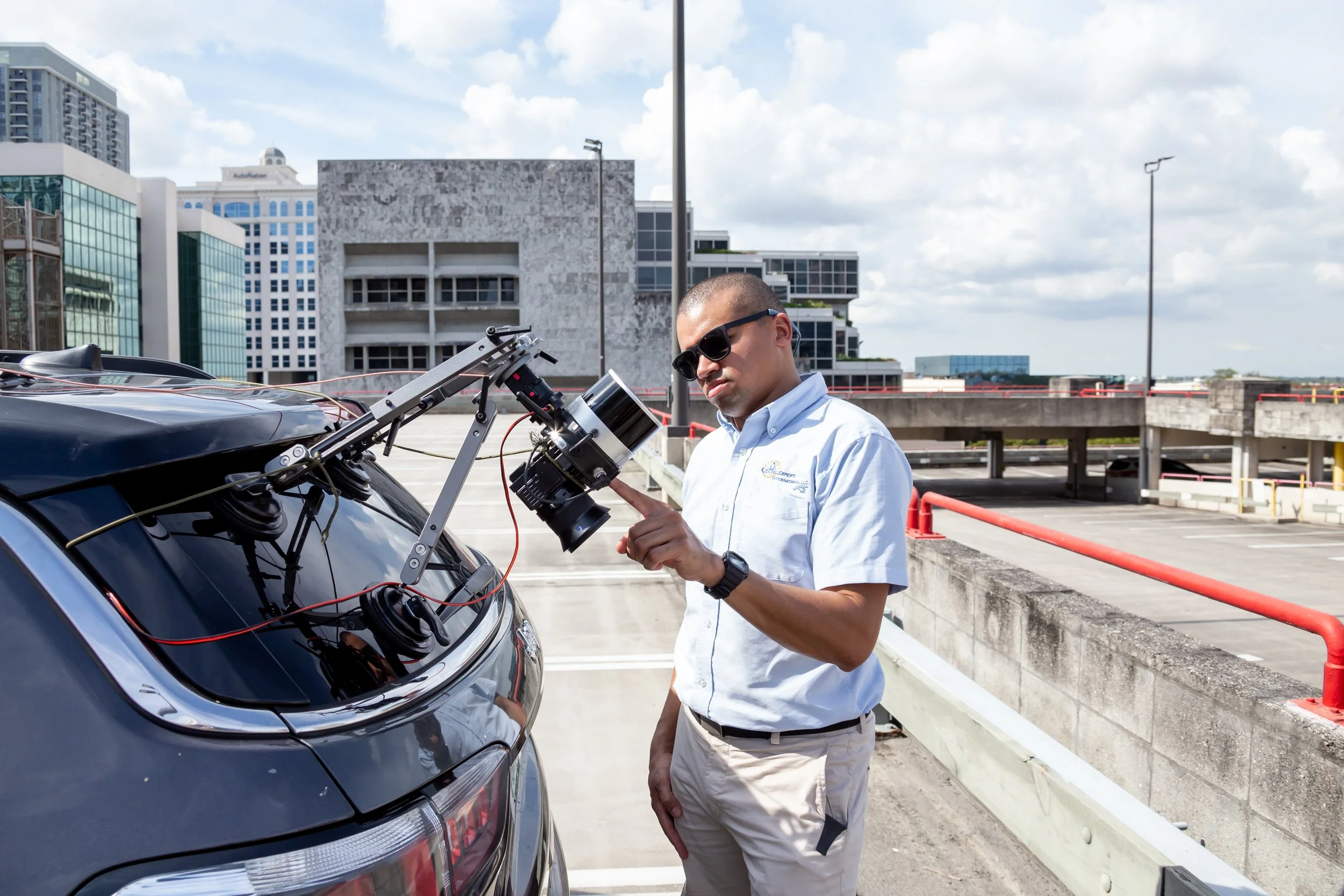
Mobile Mounted LiDAR
In this configuration, the LiDAR sensor is mounted on a mobile platform, such as a car. We can easily capture data in a city environment, long stretches of road or ground details like curbing.
-
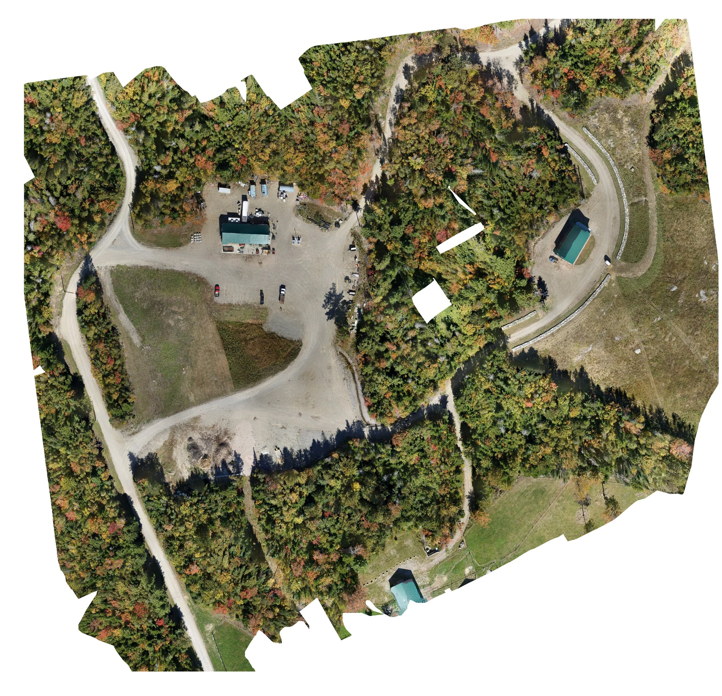
Photogrammetry
Photogrammetry mapping involves the use of specialized software to analyze and combine the aerial photographs. The resulting model can be used to obtain precise measurements, create topographic maps, and to analyze the features of the terrain.
Download the Engineering PDF
LiDAR is a rabbit hole. Below is a PDF of a brochure that has a bit more information about SkyVue LiDAR and the process. If you have any other questions, send an email or give us a call!
